
開催終了
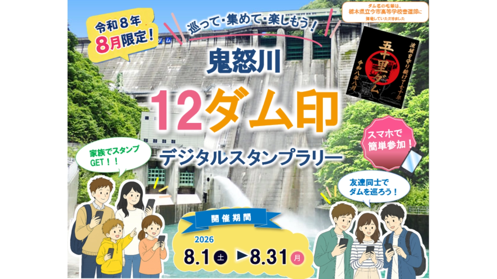
鬼怒川12ダム印デジタルスタンプラリー
「鬼怒川12ダム印デジタルスタンプラリー」は、栃木県を対象とした、furariアプリ対応のデジタルスタンプラリーです。開催期間は2026年08月01日~2026年08月31日です。



このラリーに参加する
スマートフォンとfurariアプリで参加します。

開催期間
2026年08月01日~
2026年08月31日
2026年08月31日

エリア
栃木県

チェックポイント数
12件

特典
1件

開催形式
furariアプリ版対応

ジャンル
地域イベント

主催者
国土交通省関東地方整備局鬼怒川ダム統合管理事務所 様
 ラリー概要
ラリー概要
上信越エリア(長野県・群馬県・新潟県)の絶景スポットや歴史・グルメを巡るデジタルスタンプラリーです。
対象のSA・PA、道の駅、観光スポットなどを巡ってスタンプを集めましょう。
集めたスタンプ数に応じて、上信越の品やオリジナルグッズなど豪華特典に応募できます。
対象のSA・PA、道の駅、観光スポットなどを巡ってスタンプを集めましょう。
集めたスタンプ数に応じて、上信越の品やオリジナルグッズなど豪華特典に応募できます。
 チェックポイント(12件)
全12件を表示しています。
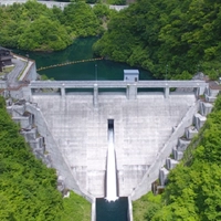
01
Mikawasawa Dam (Yunishigawa Water Village)
[River Name] Mikawasawa River, Tone River System
[Type] Gravity concrete dam
[Gate] Crest natural overflow x 5 gates
Orifice with natural adjustment × 1 gate
Jet flow gate x 1
Three multi-hole slide gates (selective water intake).
[Embank height/Embank top height] 48.5m/97.5m
[Total storage capacity] 899,000 m³
[Administrator] Tochigi Prefectural Government, Department of Land Development
[Construction Start/Completion Year] 1990/2004
[Random Information] Located upstream of Yunishigawa Onsen, about 2km along a forest road closed to vehicles from the Kurobe-Nishikawa Prefectural Road. The area is dominated by beech and oak groves, and large animals such as Asiatic black bears inhabit the surrounding area, while stream-dwelling fish such as char and trout live in the waters.
[Specialized Technology] As the presence of the Japanese Golden Eagle, a species designated as a "domestic rare wild animal and plant species," was confirmed, fixed-point surveys were conducted to prevent interference with breeding and reduce the impact of construction work. Conservation measures were also implemented, including traffic restrictions during the breeding season and the installation of privacy sheets at the construction site.
02
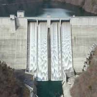
Yunishigawa Dam
[River Name] Yunishigawa River, Tone River System
[Type] Gravity concrete dam
[Gate] Natural overflow x 4 gates
Orifice gate x 1
Jet flow gates x 2
Siphon-type water intake system (selective water intake) × 22 articles
[Embank height/Embank top height] 119.0m/320.0m
[Total storage capacity] 75 million m³
[Administrator] Kanto Regional Development Bureau, Ministry of Land, Infrastructure, Transport and Tourism
[Construction Start/Completion Year] 2008/2012
[Random Information] The water source for the Yunishigawa Dam is located in a naturally rich area that is mostly included in Nikko National Park. It also boasts abundant tourist resources, such as Yunishigawa Onsen, known as the "village of the Heike clan refugees."
[Unique Technology] By using riverbed sand and gravel from the Yunishigawa River, sediment deposited in the Kawaji Dam, and construction waste materials as concrete aggregate, we eliminated the need for quarry sites. Furthermore, by minimizing road construction and preserving the forests along the lakeshore, we have strived to reduce costs and protect the environment.
03
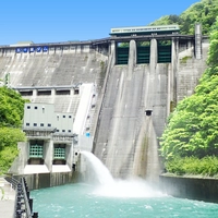
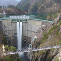
Ikarigawa Dam
[River Name] Oga River, Tone River System
[Type] Gravity concrete dam
[Gate] Crest 2-tier roller gate x 3 gates
Conduit high-pressure roller gates x 2
Jet flow gates x 2
Selective water intake facility: Multi-stage waterproof membrane gate (4 stages)
[Embank height/Embank top height] 112.0m/267.0m
[Total storage capacity] 55 million m³
[Administrator] Kanto Regional Development Bureau, Ministry of Land, Infrastructure, Transport and Tourism
[Construction Start/Completion Year] 1950/1956
[Random Information] The Igarashi Dam is connected to the Kawaji Dam by a water diversion tunnel (3m in diameter), and by effectively utilizing the two reservoirs, it ensures a stable water flow in the downstream river. This system, the first of its kind in Japan, has been in operation since March 2007.
[Unique Technology] When the Ikarigawa Dam was constructed, it was the first domestically produced high-pressure slide gate to be installed in the conduit gate. Later, in 2003, two holes were drilled in the dam body to improve the conduit gate. Furthermore, in 2019, a third hole was drilled in the dam body to install selective water intake facilities, further enhancing the dam's functionality.
04
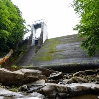
Kawamata Dam
[River Name] Kinugawa River (Tone River System)
[Type] Arch-type concrete dam
[Gate] Crest roller gate x 6
Conduit high-pressure roller gates x 2
Howell-Bunger valve x 1
Jet flow gate x 1
[Embank height/Embank top height] 117.0m/131.0m
[Total storage capacity] 87.6 million m³
[Administrator] Kanto Regional Development Bureau, Ministry of Land, Infrastructure, Transport and Tourism
[Construction Start/Completion Year] 1959/1966
[Random Information] The Kawamata Dam, built on a steep section of the Setoai Gorge, is the longest arch dam in Japan. Its crest length is 131m, while its height is 117m, resulting in a height-to-crown ratio of 0.89.
[Specialized Technology] The transmitting wall (rock improvement work) used on the left bank side of the Kawamata Dam was first constructed at the Kawamata Dam. Rock improvement work is a method that involves constructing a wall-like structure in the direction of thrust within the rock to transmit the load deep into the ground.
05
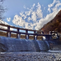
Torobe Dam (Kuriyama Hometown Products Center)
[River Name] Torobe River, Tone River System
[Type] Gravity concrete dam
[Gate] Steel roller gate x 1
[Embank height/Embank top height] 21.6m/56.0m
[Total storage capacity] 225,000 m³
[Administrator] Tokyo Electric Power Company Renewable Power Co., Ltd.
[Construction Start/Completion Year] 1962/1963
[Random Information] The dam is located on the opposite side of the reservoir from the prefectural road, so it cannot be seen directly from the road. During the harsh winter months, a beautiful natural phenomenon can be observed: the trees surrounding the reservoir are covered in frost.
[Technical Detail] The dam is a gravity-type dam constructed in 1963 during the Kinugawa River power plant expansion project. It serves as a regulating reservoir and intake dam for the Kuriyama Power Plant (output 42,000kW). In addition to one spillway gate, it also has an overflow weir for discharge. Power generation water is taken from an intake tower within the regulating reservoir.
06
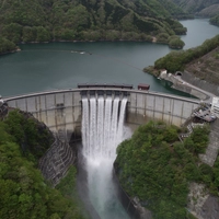
Kurobe Dam
[River Name] Kinugawa River (Tone River System)
[Type] Gravity concrete dam
[Gate] Steel roller gate x 8
[Embank height/Embank top height] 28.7m/150.0m
[Total storage capacity] 2,366,000 m³
[Administrator] Tokyo Electric Power Company Renewable Power Co., Ltd.
[Construction Start/Completion Year] 1911/1912
[Random Information] This is the first gravity-type concrete dam built in Japan for power generation. Furthermore, it was the first high dam to have spillway gates installed, with 22 wooden slide gates. Later (in 1987), renovation work was carried out due to the aging of the facilities, and it was completed in 1989, resulting in its current form.
[Special Techniques] While the dam itself is made of concrete, the dam's apron is constructed by covering the entire surface with natural stone. During the renovation work, we ensured durability while finishing it in a form that is very close to its original appearance.
07
Kawaji Dam
[River Name] Kinugawa River (Tone River System)
[Type] Arch-type concrete dam
[Gate] Crest roller gate x 6
Conduit high-pressure roller gates x 2
Jet flow gate x 2
One semicircular roller gate (selective water intake).
[Embank height/Embank top height] 140.0m/320.0m
[Total storage capacity] 83 million m³
[Administrator] Kanto Regional Development Bureau, Ministry of Land, Infrastructure, Transport and Tourism
[Construction Start/Completion Year] 1971/1983
[Random Information] Kawaji Dam was the main venue for the inaugural "Forest and Lake Appreciation Week" (July 1987). Every year, various events are held against the backdrop of the magnificent forest, promoting the conservation of the water source and fostering exchange between the upstream and downstream areas.
[Unique Technology] Kawaji Dam is a parabolic arch dam built in a steep V-shaped valley. It has a large overhang at the top elevation, extending out like an awning. Its length is 16 meters, making it one of the longest overhangs in Japan.
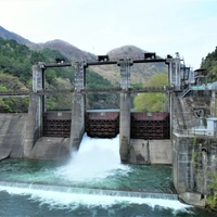
08
Koami Dam
[River Name] Nebesawa River, Tone River System
[Type] Rockfill dam
[Gate] Natural overflow
Jet flow gates x 2
[Embank height/Embank top height] 97.5m/340.0m
[Total storage capacity] 7.07 million m³
[Administrator] Tokyo Electric Power Company Renewable Power Co., Ltd.
[Construction Start/Completion Year] 1980/1987
[Random Information] Located adjacent to Nikko National Park, this area boasts abundant nature. Mount Gassan, situated on the left bank of the dam, is home to a large cluster of Rhododendron yedoense var. poukhanense. On clear days, the view of the dam lake from Kirifuri Plateau is spectacular.
[Unique Technology] Kuriyama Dam is the upper dam of the Imaichi Power Plant, a pure pumped-storage power plant, and was constructed at an altitude of over 1,000m above sea level to obtain the necessary head. It is a central earth-fill rockfill dam, and 2.5 million m³ of rock material for the dam's embankment was collected from within the reservoir to protect the natural environment and reduce construction costs.
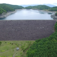
09
Kuriyama Dam (Kuriyama Hometown Products Center)
[River Name] Nebesawa River, Tone River System
[Type] Rockfill dam
[Gate] Natural overflow
Jet flow gates x 2
[Embank height/Embank top height] 97.5m/340.0m
[Total storage capacity] 7.07 million m³
[Administrator] Tokyo Electric Power Company Renewable Power Co., Ltd.
[Construction Start/Completion Year] 1980/1987
[Random Information] Located adjacent to Nikko National Park, this area boasts abundant nature. Mount Gassan, situated on the left bank of the dam, is home to a large cluster of Rhododendron yedoense var. poukhanense. On clear days, the view of the dam lake from Kirifuri Plateau is spectacular.
[Unique Technology] Kuriyama Dam is the upper dam of the Imaichi Power Plant, a pure pumped-storage power plant, and was constructed at an altitude of over 1,000m above sea level to obtain the necessary head. It is a central earth-fill rockfill dam, and 2.5 million m³ of rock material for the dam's embankment was collected from within the reservoir to protect the natural environment and reduce construction costs.
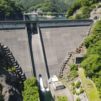
10
Imaichi Dam (Nikko Roadside Station, Nikko Honjin Tourist Information Center)
[River Name] Togawa River, Tone River System
[Type] Gravity concrete dam
【Gate】Roller gate x 2
Jet flow gates x 2
[Embank height/Embank top height] 75.5m/177.0m
[Total storage capacity] 8.91 million m³
[Administrator] Tokyo Electric Power Company Renewable Power Co., Ltd.
[Construction Start/Completion Year] 1980/1986
[Random Information] The Imaichi Power Plant is constructed in an egg-shaped underground cavity located 400 meters below the surface, measuring 33.5 meters wide, 51 meters high, and 160 meters long.
[Unique Technology] The Imaichi Dam is the lower dam of the Imaichi Power Plant, a pure pumped-storage power plant. In order to protect the natural environment and reduce construction costs, a large amount of rock excavated from the mountain to construct the underground power plant was used as concrete material for the dam.
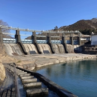
11
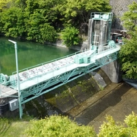
Nakaiwa Dam (Nikko Roadside Station, Nikko Honjin Tourist Information Center)
[River Name] Kinugawa River (Tone River System)
[Type] Gravity concrete dam
[Gate] Steel roller gate x 5
[Embank height/Embank top height] 26.3m/107.9m
[Total storage capacity] 1,488,000 m³
[Administrator] Tokyo Electric Power Company Renewable Power Co., Ltd.
[Construction Start/Completion Year] 1922/1924
[Random Information] This is an arch-shaped gravity dam located just south of the Kinugawa Onsen hot spring resort area. It serves as a water intake dam for the Nakaiwa Power Plant, and also stores the large volume of water discharged from the upstream Takenosawa and Kinugawa Power Plants, maintaining a constant flow rate through a reverse regulation mechanism.
[Unique Technology] This is one of the few pre-war gravity arch dams and has been selected as one of the "2000 Important Existing Civil Engineering Structures - Modern Civil Engineering Heritage of Japan" by the Japan Society of Civil Engineers. A fish ladder has been installed on the right bank downstream of the dam to help fish swim upstream.
12
Chuzenji Dam
[River Name] Otani River, Tone River System
[Type] Gravity concrete dam
【Gate】Roller gate x 2
Sluice gate x 1
[Embank height/Embank top height] 6.4m/25.1m
[Total storage capacity] 25.1 million m³
[Administrator] Tochigi Prefectural Enterprise Bureau
[Construction Start/Completion Year] Completion: 1957/1960
(Redevelopment: 1991/1999)
[Random Information] The river basin includes the Oku-Nikko wetlands (such as Senjogahara), which are registered under the Ramsar Convention, and breeding of wetland plants such as cotton grass and birds such as the Siberian Stonechat has been confirmed there. Downstream are the Nikko shrines and temples (Futarasan Shrine, Toshogu Shrine, and Rinnoji Temple), a World Heritage site, which attract many tourists from both Japan and abroad every year.
[Specialized Technology] To improve the flood control capacity of the Chuzenji Dam, we constructed bypass spillways and other facilities. This dam regulates not only the water level of Lake Chuzenji, a natural lake, but also the water flow of Kegon Falls, one of Japan's three most famous waterfalls.
 特典(1件)

Complete Bonus
12ダムすべてのスタンプを集めた方限定!
「鬼怒川12ダム印デジタルスタンプラリー」全12か所のスタンプをコンプリートすると、ここでしか手に入らない限定オリジナルスマホ壁紙をプレゼント!
コンプリートの記念として、ぜひ限定デザインをゲットしてください。
 備考・注意事項
【ラリー参加者様向け】よくあるご質問につきましては、以下をご確認ください。
・アプリからご参加の方:https://furari.jp/faq_user/app/ja/
・WEBブラウザからご参加の方:https://furari.jp/faq_user/
・アプリからご参加の方:https://furari.jp/faq_user/app/ja/
・WEBブラウザからご参加の方:https://furari.jp/faq_user/


今すぐはじめよう!


ダウンロードはこちら(無料)